
Esri ArcGIS Pro Foundation Certification Practice Test
$69.00
- Buy to unlock unlimited access to all Quiz questions and Answers in this Quiz.
- After purchase you can print a PDF of the whole quiz at any point. The PDF will contain the questions and the correct answers.
About this Exam
The Esri ArcGIS Pro Foundation Certification is designed for individuals who possess entry-level knowledge of Geographic Information Systems (GIS) and have experience applying ArcGIS concepts to basic workflows. This certification validates a user's competence in foundational tasks within the ArcGIS Pro environment, such as data management, mapping, visualization, analysis, and sharing. It is an ideal starting point for recent graduates, career-changers, and those who have zero to two years of hands-on experience with ArcGIS Pro. Earning this certification demonstrates to employers that you have the essential skills to support spatial data projects and effectively contribute to a GIS team. It is the first step on the Esri Technical Certification pathway, paving the way for more advanced specialist and professional-level credentials.
Ready to test your knowledge?
Buy Now to Access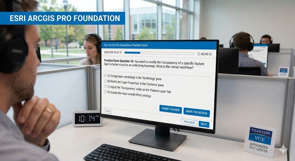
Additional Information
What the Course Entails and Exam Details
The exam measures a candidate's ability to complete fundamental tasks across four core domains. These areas focus on the practical application of ArcGIS Pro rather than just theoretical knowledge. The key skills and topics covered include:
• Data Management (32%): This section evaluates your ability to organize workspaces, manage tabular data, create file geodatabases, define feature classes, perform basic data editing, and understand coordinate systems. You'll need to demonstrate the correct methods for accessing data properties and metadata.
• Mapping and Visualization (36%): This is the largest portion of the exam, testing your skills in ArcGIS Pro navigation, modifying layer symbology and labels, configuring map and layer properties, and identifying the appropriate steps for adding and viewing data at various scales.
• Layouts and Sharing (12%): Candidates must know how to create and export map layouts, understanding how to communicate effectively through cartographic output. This includes familiarity with sharing content to ArcGIS Online or a portal.
• Performing Analysis (20%): This domain covers basic spatial analysis workflows. You should be able to select features interactively by attribute or location and use common proximity and overlay geoprocessing tools to answer basic spatial questions.
What to Expect in the Final Exam
The official certification exam, which is available in a standard operational state, consists of 75 multiple-choice questions. You will be given a time limit of 1 hour and 30 minutes (90 minutes) to complete the test. The exam is conducted only in English. Esri does not publish a specific passing score percentage; instead, candidates are given a pass or fail result. A numerical score report is not provided. The questions are designed to test your actual experience with the software, so a strong practical familiarity with ArcGIS Pro workflows is essential for success. The certification code for the current operational exam is EAPF 2025.
How to Study and Exam Centers
To prepare for the ArcGIS Pro Foundation certification, a multi-faceted study approach is recommended. First, review the official Esri ArcGIS Pro Foundation 2025 Exam Information Guide, which contains a detailed checklist of "Skills Measured" to help identify your knowledge gaps. Esri offers various training resources, including e-learning courses, instructor-led training, and documentation.
We highly recommend taking timed practice tests. Practice exams, such as those provided in this guide, are instrumental in simulating the actual test environment, helping you manage your time effectively, and understanding the phrasing of questions. Focus your study on the weighted percentages of each domain, devoting extra time to Mapping and Visualization and Data Management. Practical, hands-on application of these workflows is crucial.
The exam is administered through Esri’s testing partner, Pearson VUE. You can take the exam in person at a global network of Pearson VUE authorized testing centers or online through their proctored environment, using your own computer with a webcam and reliable internet. Registration for the exam is managed directly through the Pearson VUE website.
Job Opportunities from the Course
Passing the ArcGIS Pro Foundation exam serves as a robust validation of your essential GIS skills, making you more competitive for entry-level roles in a wide range of industries that utilize geospatial technology.
Successful certification can open doors to the following specific job opportunities: • GIS Technician • GIS Specialist • GIS Analyst • Entry-level GIS Professional • GIS Data Editor • Cartographic Technician • Research Assistant • Urban Planning Assistant • Environmental Analyst • Non-GIS Professional transitioning into a GIS role
Frequently Asked Questions
Reviews
5.0
Based on 0 reviews
Leave a Review
No reviews yet. Be the first to review!