Geodetic Engineer Board Practice Exam
$69.00
- Buy to unlock unlimited access to all Quiz questions and Answers in this Quiz.
- After purchase you can print a PDF of the whole quiz at any point. The PDF will contain the questions and the correct answers.
About this Exam
The Geodetic Engineer Licensure Examination, commonly referred to as the Geodetic Engineer Board Exam, is the definitive regulatory test for aspiring professionals in the Philippines. Administered by the Professional Regulation Commission (PRC), this exam is specifically designed for graduates of the Bachelor of Science in Geodetic Engineering program. It serves as a comprehensive assessment of an individual’s technical knowledge, practical skills, and ethical understanding required to practice geodetic engineering professionally. Obtaining this license is mandatory for anyone looking to legally perform land surveys, determine property boundaries, design maps, and manage geospatial data within the country.
Ready to test your knowledge?
Buy Now to Access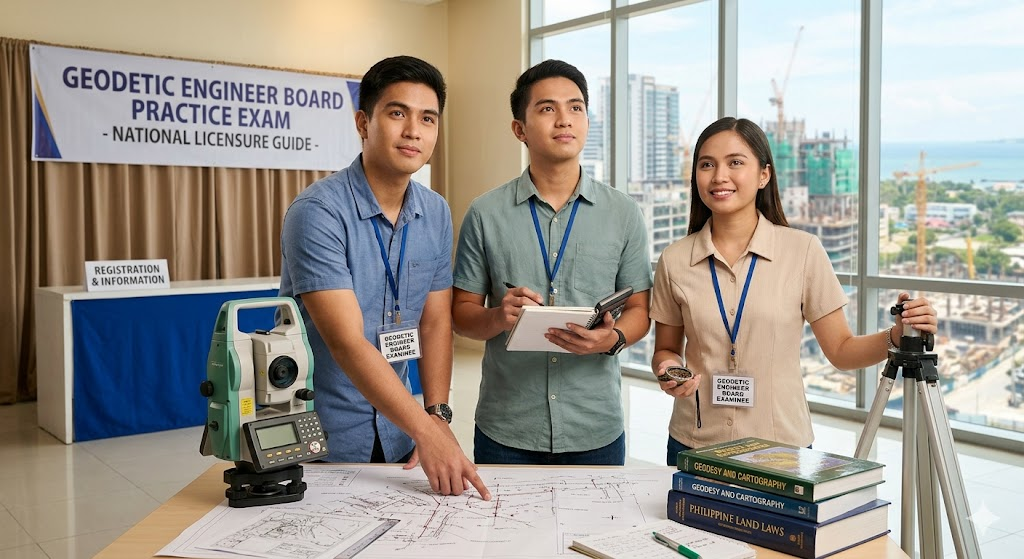
Additional Information
What the Course Entails and Exam Details
This examination covers a broad and complex spectrum of engineering, mathematical, and legal topics. It is split into five main subject areas, each typically accounting for a significant portion of the final score. These core areas include: 1) Laws, Rules, and Regulations, which tests knowledge of the Philippine Geodetic Engineering Act, land registration laws, and professional ethics; 2) Mathematics, encompassing advanced algebra, calculus, spherical trigonometry, and error theory; 3) Theory and Practice of Surveying, including control surveys, topographic mapping, hydrographic surveys, and construction surveying; 4) Geodesy, focusing on the figure of the Earth, coordinate systems, and satellite positioning; and 5) Cartography, which covers map projections, design, and Geographic Information Systems (GIS).
What to Expect in the Final Exam
The Geodetic Engineer Board Exam is a rigorous, two-day event. The format is strictly multiple-choice, demanding both speed and accuracy from examinees across all subject clusters. Each of the five main subjects is presented in a separate testing session. To successfully pass the licensure exam, a candidate must obtain a general weighted average of at least seventy percent (70%), with no grade lower than fifty-five percent (55%) in any given subject. Candidates should prepare for a full-day schedule on both days, with each subject session usually lasting several hours. There are strict rules regarding permitted calculators and necessary documentation, such as the Notice of Admission (NOA), which must be adhered to.
How to Study and Exam Centers
Effective preparation requires a multi-faceted approach. First, a structured study plan should be developed, allocating time based on the weight of each subject and personal areas of weakness. Utilizing a variety of trusted resources is critical, including official PRC table of specifications, recognized engineering textbooks on geodesy and surveying, and updated reference manuals on Philippine land laws. A pivotal strategy is solving past board exam questions to understand the question style and time management. Many students also find value in enrolling in reputable review centers. The actual licensure exam is not online; it is conducted at designated physical testing centers across the Philippines, such as in Manila, Baguio, Cebu, Davao, and other regional hubs. Applications are submitted via the PRC’s official online portal, the Licensure Examination and Registration Information System (LERIS).
Job Opportunities from the Course
Becoming a licensed Geodetic Engineer unlocks a diverse range of career paths in both the public and private sectors. The specialized skills in precise measurement and spatial data analysis are highly valued in construction, real estate, environmental management, and governance. Here are specific job titles and career paths this certification unlocks:
Geodetic Engineer
Land Surveyor
GIS Specialist / Manager
Geospatial Analyst
Cartographer
Hydrographic Surveyor
Mine Surveyor
Project Control Engineer
Cadastral Survey Chief
Remote Sensing Specialist
Right-of-Way (ROW) and Land Acquisition Officer
University Instructor in Geodetic Engineering
Government Engineer (e.g., Department of Environment and Natural Resources - DENR)
Construction Survey Chief
Frequently Asked Questions
Reviews
5.0
Based on 0 reviews
Leave a Review
No reviews yet. Be the first to review!