
IGCSE Coasts Practice Test
$69.00
- Buy to unlock unlimited access to all Quiz questions and Answers in this Quiz.
- After purchase you can print a PDF of the whole quiz at any point. The PDF will contain the questions and the correct answers.
About this Exam
The IGCSE Coasts module is a critical and captivating section of the IGCSE Geography curriculum. It explores the dynamic relationship between the land and the sea, focusing on how different processes shape the physical landscape and how humans interact with and manage these environments. This guide and practice exam are tailored specifically for secondary school students preparing for the official IGCSE certification. Whether you are studying through Cambridge (CIE), Edexcel, or another examining body, this resource is designed to sharpen your understanding of coastal systems and refine your exam technique, setting you on the path to a top grade.
Ready to test your knowledge?
Buy Now to Access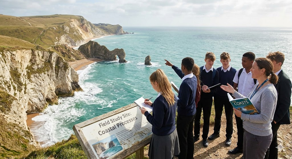
Additional Information
What the Course Entails and Exam Details
The Coasts module challenges you to think like a geographer, combining theoretical knowledge with practical analysis.
You will begin by examining coastal systems, understanding the factors that influence them, and learning to distinguish between constructive and destructive wave types. The core of this course focuses on the "three processes": Marine Erosion, Transportation (including Longshore Drift), and Marine Deposition. Mastery of these processes is essential for explaining how different coastal landscapes are formed.
Furthermore, you will delve into specific coastal landforms, learning to identify and explain the creation of erosional features such as cliffs and wave-cut platforms, and depositional features like spits and bars. The curriculum also has a heavy emphasis on Coastal Management, requiring you to evaluate various hard and soft engineering strategies and support your analysis with specific case studies.
What to Expect in the Final Exam
It's crucial to understand that Coasts is not a standalone "practice test" in the final setting, but a key topic within your primary IGCSE Geography exam papers. In the final written exam (typically Paper 1 for CIE), you will likely have to answer questions from a selection of physical geography themes, with Coasts being a frequent and high-scoring option.
The exam structure involves a blend of short-answer questions and more in-depth, structured responses. You can expect questions that provide you with "resources"—such as maps, diagrams, or photographs of a coastline—and ask you to describe and explain the features shown. For the highest marks, you will need to apply your case study knowledge and include annotated diagrams to illustrate formation processes, all while keeping within the allocated time (usually about 45 minutes for a single complete theme like Coasts). The overall paper time limit is typically 1 hour and 45 minutes, requiring focused and disciplined time management.
How to Study and Exam Centers
Preparation for the IGCSE Coasts exam must go beyond simple reading; it requires active application.
Study Strategies:
Draw Diagrams: Practice drawing landform formations (e.g., a split forming) from memory and adding detailed labels. Examiners love annotated diagrams.
Flashcards for Terms: Create flashcards to memorize definitions of key terms like hydraulic action, attrition, and tombolo.
Case Study Profiles: Develop a concise "one-pager" for your chosen case studies (one for erosion/landforms and one for management), including specific facts, statistics, and place names.
Timed Past Papers: This is the most critical step. Get hold of previous IGCSE Geography exam papers, answer the coast questions under exam conditions, and then grade yourself strictly using the official mark scheme.
Exam Centers: As this is a component of a larger qualification, your official exam is taken at your registered school or an approved examination center. Most students are automatically registered through their own secondary school or college. If you are a private candidate studying independently, you must locate and register at an authorized center, such as a British Council office or a certified private tuition center, that is certified to host IGCSE exams for your specific examining board (e.g., Pearson VUE for Edexcel, or a registered CIE school).
Job Opportunities from the Course
A strong result in IGCSE Geography, especially in a technical module like Coasts, lays the foundational knowledge for numerous rewarding career paths focused on the environment, physical planning, and sustainability.
This certification can be your first step toward roles such as:
Coastal Engineering Specialist
Environmental Consultant
Marine Surveyor or Oceanographer
Geological Surveyor
Sustainable Tourism Officer
Cartographer or GIS (Geographic Information Systems) Analyst
Town and Country Planner (with a focus on coastal resilience)
Conservation Officer
Frequently Asked Questions
Reviews
5.0
Based on 0 reviews
Leave a Review
No reviews yet. Be the first to review!